Solutions

Enable reservoir intelligence with super-resolution technologies

End-to-end services for your data super-resolution and development planning needs, from reprocessing legacy seismic to ranking well paths in a mature field.

Sharper insights. Faster decisions. A more productive tomorrow.

01 · Enabling better processing

Imaging & data processing

Lift the resolution and clarity of the seismic you already have, without reacquisition. Drag across each image to compare legacy seismic before and after.

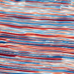
Chandon Field inline 1405, south-west of the Chandon-2 well, across rotated fault blocks: the legacy seismic and the same line after Enhance.AI, with more continuous reflections and cleaner fault terminations. Legacy seismic Enhance.AI

Enhance.AI

Structural & stratigraphic enhancement

Imaging and reprocessing that delivers unmatched clarity and sharper fault delineation. Bring out the best from your legacy data and cut your reprocessing cost and effort.

  • Enhances structural features and channels
  • Makes faults sharper
  • Handles noise and amplitude distortions robustly
Ready in a few hours Explore Enhance.AI
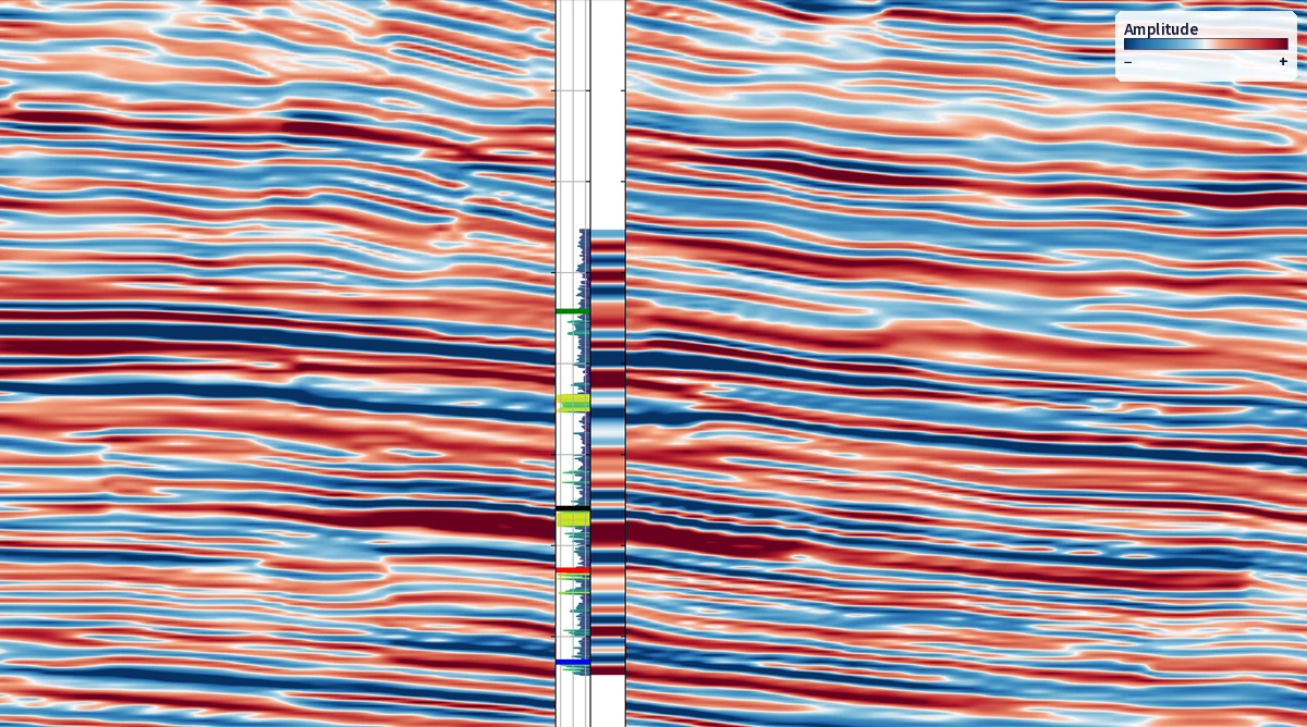
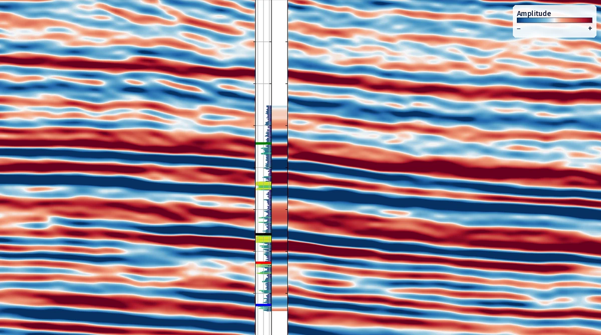
Storm 3.0 Legacy seismic Storm 3.0

Storm 3.0

Super-resolution seismic imaging

A post-stack super-resolution volume that delineates thin beds down to 3 m and offers consistent well ties close to well-resolution scale.

  • Up to 5x resolution enhancement
  • Enhanced structural continuity and fault delineation
  • Consistent well ties
Ready in 4–6 weeks Explore Storm 3.0

See it on real data

Enhance deeper subsurface insights with AI-powered super-resolution

See how Enhance.AI and Storm 3.0 bring out the best from legacy data, and cut reprocessing cost and effort.

Unsure where to begin transforming your legacy volume to super-resolution? Talk to us. Our experts will review your data and design the best workflow for your needs.

02 · Image-based modelling

Modelling & interpretation

Super-resolution-backed reservoir models deliver more actionable insights. Build inversions, horizon cubes and fault networks that honour the geology and the wells.

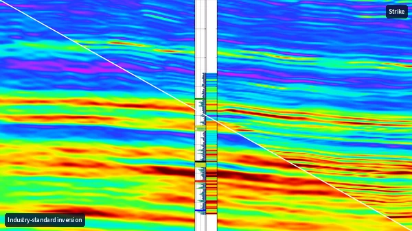
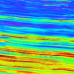
Impedance section split diagonally: an inversion from industry-standard software on the left, the Strike super-resolution inversion on the right with thinner, sharper layers.

Strike

Super-resolution inversions

A super-resolution inversion volume that delineates complex depositional geometry and rock-property variation in thin stratigraphic features away from the well.

  • Up to 5x more information
  • Rock-property variations in thin beds down to 3 m
  • Better continuity of property models away from the wells
Ready in 3–4 weeks Explore Strike
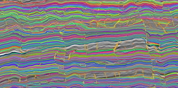
Strat.AI horizons tracked through faults (orange lines) on Chandon crossline 87

Strat.AI

AI-driven super-resolution horizon cube

AI-generated horizon and stratigraphy volume tracking that follows complex structure accurately, even across faults.

  • A relative geologic time value for every sample
  • Tracks stratigraphic features more accurately
  • Honours continuity across faults
Cuts interpretation time by days Explore Strat.AI
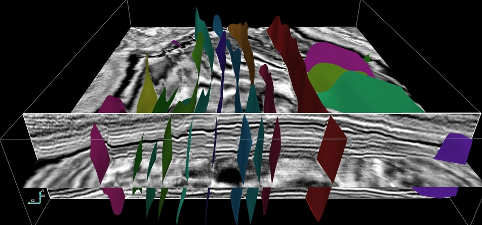
Fault surfaces from Fault.AI on the F3 survey (Dutch North Sea), one colour per fault, shown in 3D with seismic sections

Data: F3 Netherlands, dGB Earth Sciences (TerraNubis), CC BY-SA 3.0.

Fault.AI

AI-driven 3D fault geometry mapping

AI-generated, unsupervised mapping of complex fault systems in minutes, powered by the structurally enhanced Storm 3.0 super-resolution volume.

  • Automated tracking free of human bias
  • Intelligent correlation to map polyphase faulting
  • Sharper definition of structural geometry
Ready in a few minutes Explore Fault.AI

See it on real data

Visualise what's beneath with super-resolution modelling

See how Strike reveals lateral rock-property variations in thin beds, away from the well.

Unable to interpret complex structural features because of poor image quality? Talk to us. Our experts will review your data and design the best workflow for your needs.

03 · Efficient field development planning

Bidding & field development planning

Find what is left in mature fields and plan wells with confidence. Prolytix turns super-resolution property models into volumes, sweet spots and ranked well paths.

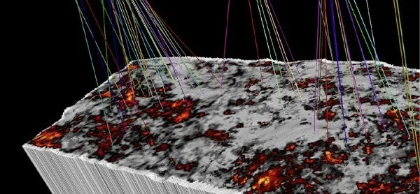
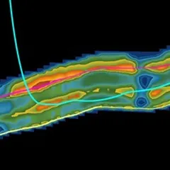
A Prolytix 3D reservoir volume showing a speckled property model with well trajectories above it.
Prolytix volume
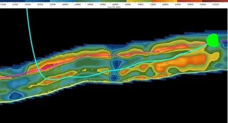
A property section along a reservoir interval with optimised well paths drawn through the high-value zones.
Optimised well paths
  • Identify missed zones and infer zones for additional perforation
  • Discriminate fluid properties and map fluid distribution
  • Optimise well paths for high productivity
  • Formulate efficient redevelopment strategies

Prolytix

Mature-field redevelopment intelligence

AI-based integrated modelling that locates hydrocarbon sweet spots and remaining oil and gas in 3D space at mid-life and mature stages of field development.

  • Volumetric assessment

    Estimate the leftover and recoverable hydrocarbons in place using super-resolution property models.

  • Well and recompletion planning

    Identify and rank optimised well paths, recompletion strategies, vertical sweet spots and horizontal wells.

Ready in 12 weeks CAPEX savings and production front-ending

Planning an asset development strategy or seeking new investment? Our experts will review your data and design the best workflow for your needs.

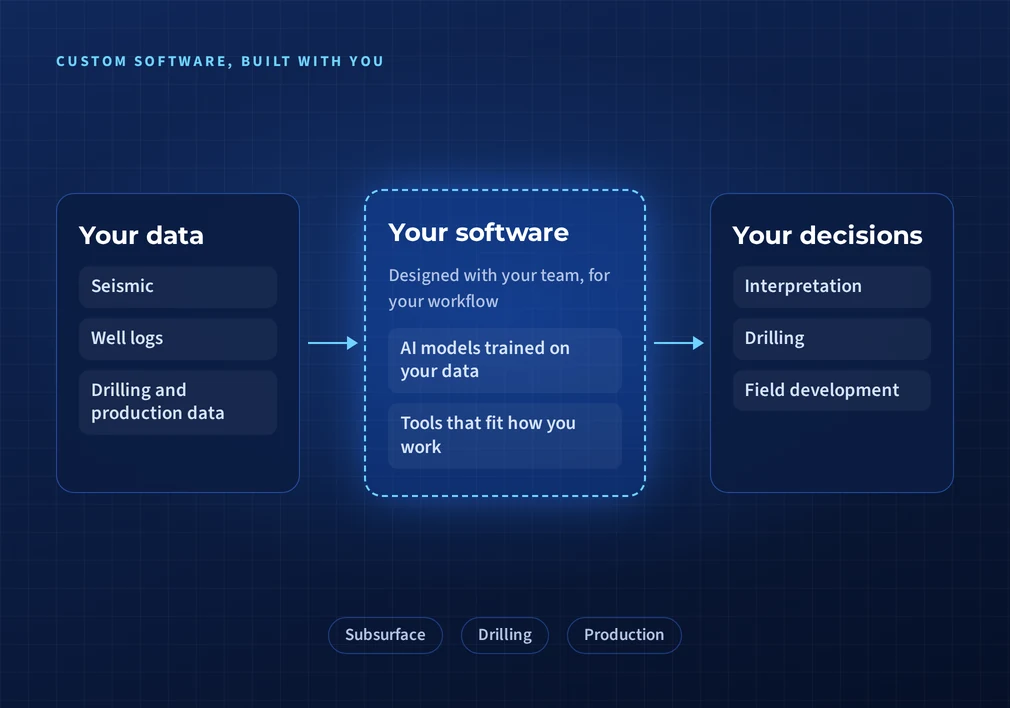
Diagram: your data (seismic, well logs, drilling and production data) goes into software designed with your team, which supports your decisions in interpretation, drilling and field development.
Custom software, from your data to your decisions

04 · Software development and consultancy

Custom AI software for your workflow

Bespoke software built around your requirements and your data, from interpretation to drilling and production. It does not have to involve super-resolution: we design it with your team and use whatever methods fit the problem.

  • DIMEDeep Information Maximization Engine

    Vision-AI foundation models that turn low-resolution data into 5x super-resolution outputs.

  • IRADeep learning platform

Working with us

From your data to a workflow that fits

Every engagement starts with your data, not a fixed package.

  1. 01

    Tell us your objective

    Imaging, interpretation, a development plan or a custom build. Start with the question you need answered.

  2. 02

    Our experts review your data

    Our team of experts looks at the data you have before recommending anything.

  3. 03

    We design your workflow

    You get the combination of services that best suits your needs, not a fixed package.

  4. 04

    Results on your data

    Turnaround ranges from a few minutes for Fault.AI to 12 weeks for Prolytix.

Are you ready to make your subsurface work smarter?

Are you extracting every ounce of information from your data? Reveal the true value of the seismic you already own, in super-resolution.