
Our products
More than what meets the eye
As the subsurface comes alive. Nine deep-learning products, one engine: from super-resolution imaging and inversion to fault and horizon interpretation and field development planning.
Transforming subsurface insight with AI
DIME at work
Interpretation & modelling at super-resolution
DIME uses well properties to increase the information in 3D volumes, creating super-resolution datasets that reveal thin beds and finer stratigraphic detail.
-
Thin beds, resolved
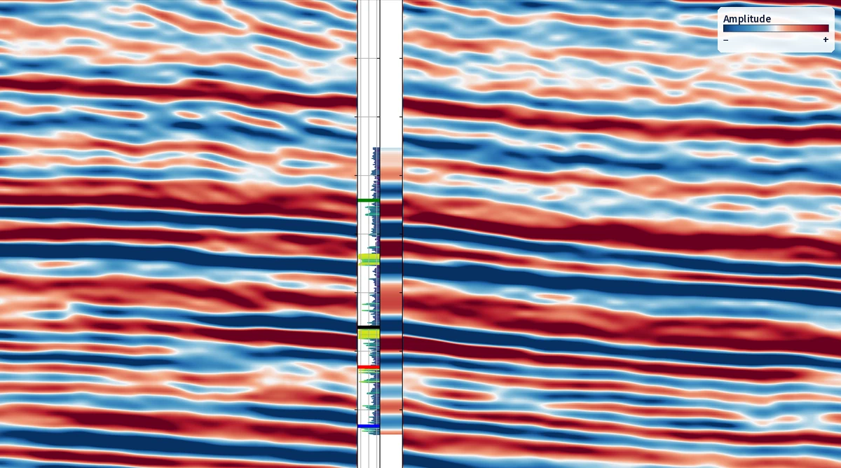
Low-resolution subsurface models make it hard to locate oil and gas accurately. Super-resolution brings thin beds into view.
-
Vision-AI foundation models
DIME turns low-resolution data into up to 5x super-resolution outputs.
-
Guided by your wells
Well information is injected across frequency bands, so the added detail stays tied to measured data.
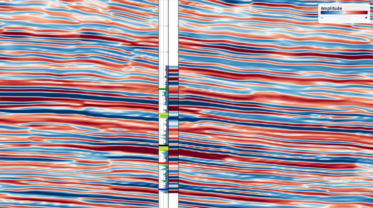 Conventional processing
Rezlytix super-resolution
One engine, nine products
Our deep-learning products
Each product covers one step of the subsurface workflow, from imaging to development planning. Select one to jump to it.
 Every product runs on DIME
Deep Information Maximization Engine
-
01
Imaging & Data Processing
Lift the resolution and clarity of the seismic you already have, without reacquisition.
-
02
Modelling & Interpretation
Build reservoir models, faults and horizons at super-resolution, honouring the geology and the wells.
-
03
Field Development Planning
Find what is left in mature fields and plan wells with confidence.



Modelling & Interpretation
Log.AI
Recover missing log information
Reconstructs missing well-log information so every well can contribute to the model.


BeforeLegacy seismic on the Chandon Field: inline 1405, across rotated fault blocks south-west of the Chandon-2 well
AfterEnhance.AI on the same inline: more continuous reflections and cleaner fault terminations
Imaging & Data Processing

Enhance.AI
Structural & stratigraphic enhancement
Goes beyond the limits of conventional smoothing and filtering: cleaner amplitudes and sharper fault delineation on the data you already have.
- Ready in a few hours
- Matching high-resolution image and channel maps
Superior image quality and clearer feature delineation than industry-standard products.
 Ambiguous anomaly location
Wedge 2.0: precise location in time
BeforeAmbiguous location of the low-frequency anomaly
AfterPrecise location in time for the low-frequency anomaly, resolved using Wedge 2.0
Imaging & Data Processing

Wedge 2.0
Super-resolution spectral decomposition
Improves on conventional Fourier-transform-based spectral decomposition, giving sharper resolution of low-frequency anomalies.
- Ready in a few hours
- Matching high-resolution decomposition
Superior temporal resolution at low frequencies compared with industry-standard algorithms.
Legacy seismic
Storm 3.0
BeforeLegacy seismic around a well, at its original resolution
AfterStorm 3.0 on the same line: finer stratigraphic detail, with about twice as many reflections in every 100 ms
Imaging & Data Processing

Storm 3.0
Super-resolution seismic imaging
Well-guided, structurally constrained resolution enhancement with an improved signal-to-noise ratio, free from amplitude and phase distortions.
- Ready in 4–6 weeks
- A fraction of re-acquisition cost
Resolves geological detail in legacy seismic that was previously uninterpretable.

Imaging & Data Processing
SAQI
Super-resolution pre-stack seismic imaging
Brings DIME super-resolution to pre-stack seismic data.
Every strip covers the full angle range, 0° to 45°
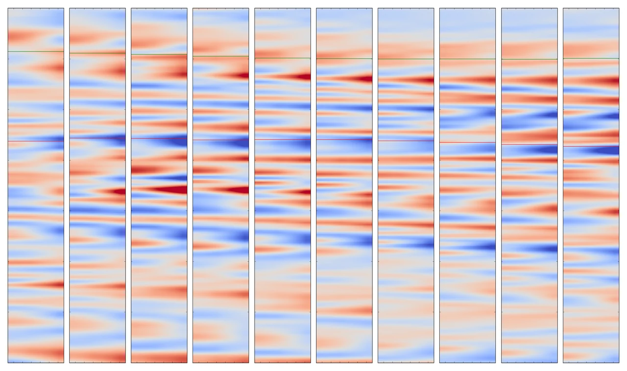 Input gathers
SAQI
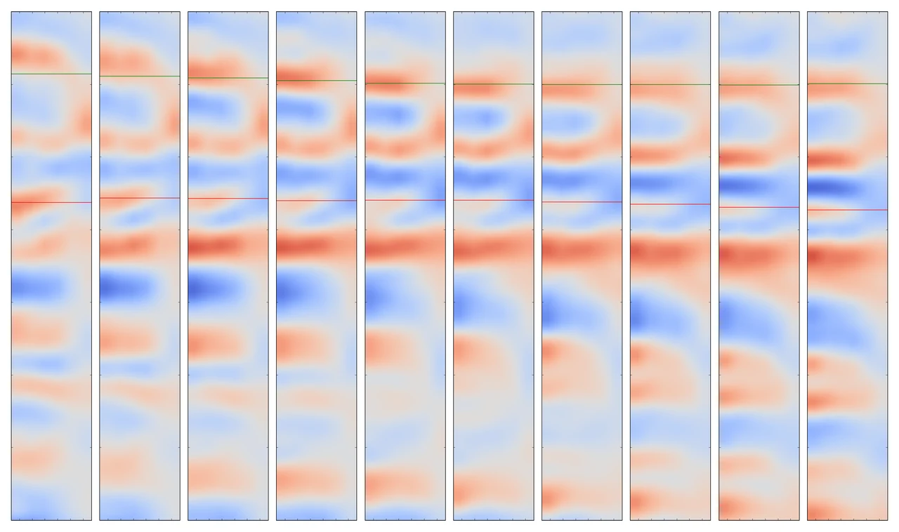
BeforeInput: ten angle gathers, each strip spanning 0° to 45° (case study 005, AVO-compliant gather super-resolution)
AfterSAQI: the same ten gathers, with thinner, more numerous events
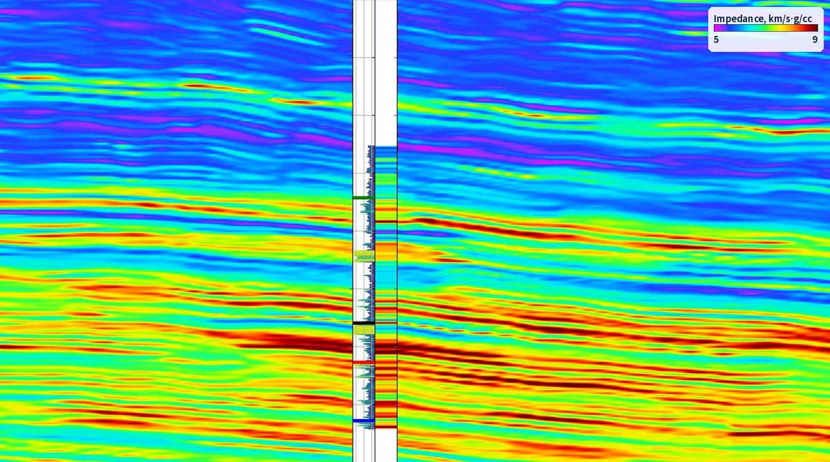 Industry-standard inversion
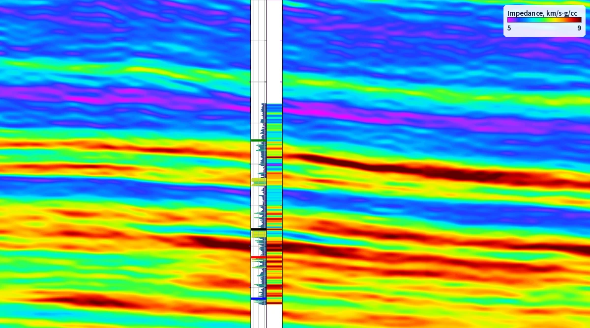
Strike
BeforeIndustry-standard (HR) inversion: thin beds away from the well are not resolved
AfterStrike on the same line and impedance scale: thinner layers and how they vary away from the well
Modelling & Interpretation

Strike
Super-resolution inversions
An unbiased deep-learning inversion architecture, free of wavelet and phase-stationarity assumptions, that generates realistic geological models away from the wells.
- Ready in 3–4 weeks
- Matching high-resolution impedance dataset
Reveals lateral rock-property variations in thin beds away from the well.
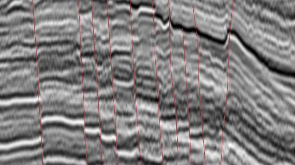 Input seismic, no faults picked
Fault.AI: automatic fault picks
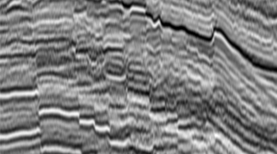
BeforeF3 survey (Dutch North Sea), crossline 38: the seismic section
AfterThe same section with the fault traces picked by Fault.AI, in red
Data: F3 Netherlands, a public dataset made available by dGB Earth Sciences through TerraNubis under CC BY-SA 3.0; original seismic NAM, via NLOG.
Modelling & Interpretation

Fault.AI
AI-driven 3D fault geometry mapping
Detailed, accurate correlation of discontinuities and mapping of fault planes with their genetic relationships.
- Ready in a few minutes
- Matching high-resolution fault picking
No seed points needed, with better fault-likelihood and thinning performance on super-resolution data.
Modelling & Interpretation

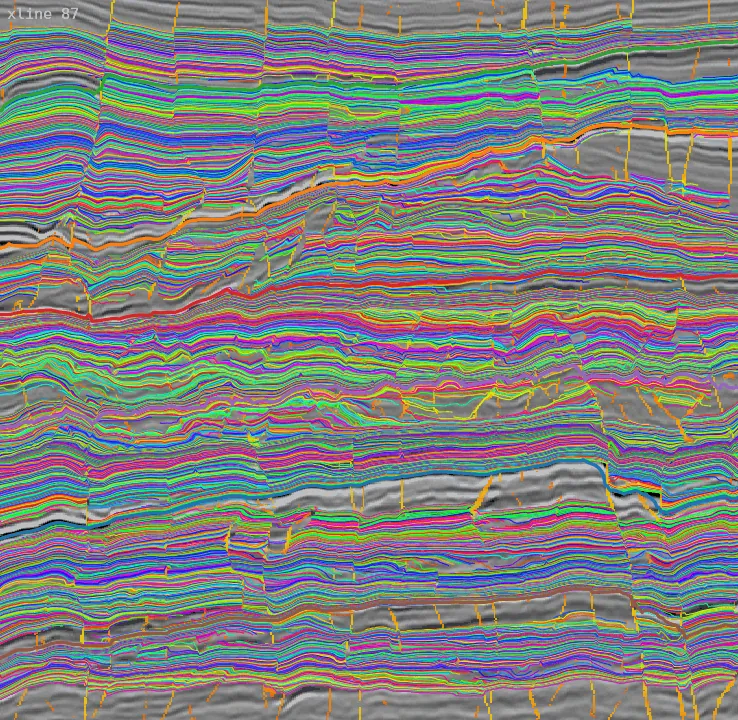
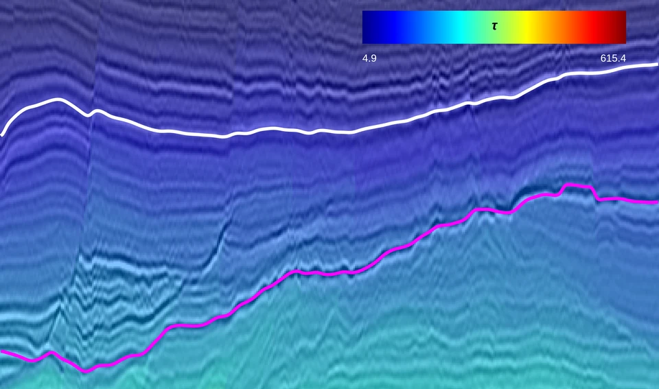
Strat.AI
AI-driven super-resolution horizon cube
Combines unconformity detection, horizon mapping and chronostratigraphic tracking, running on super-resolution inputs.
- Cuts interpretation time by days
- Full 3D relative geologic time cubes
Interpret previously unresolved structural and stratigraphic detail with confidence.
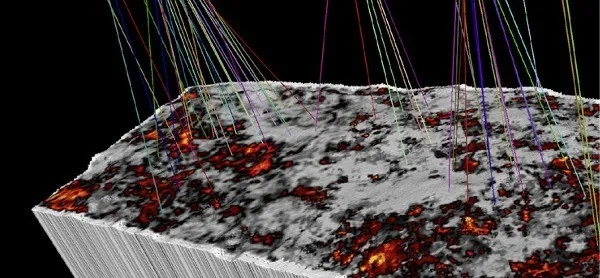
Prolytix volume
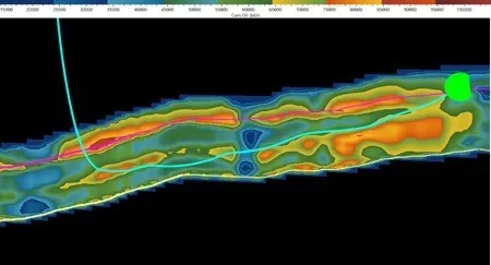
Optimised well paths
Field Development Planning

Prolytix
Mature-field redevelopment intelligence
AI-based integrated modelling that locates hydrocarbon sweet spots and remaining oil and gas in 3D space at mid-life and mature stages of field development.
- Ready in 12 weeks
- CAPEX savings and production front-ending
Quantify recoverable hydrocarbon volumes and map undiscovered high-productivity zones in 3D.
Book a discussion to take a deep dive
You have seen what our products can do. Don't just take our word for it: see the true potential of your own data.